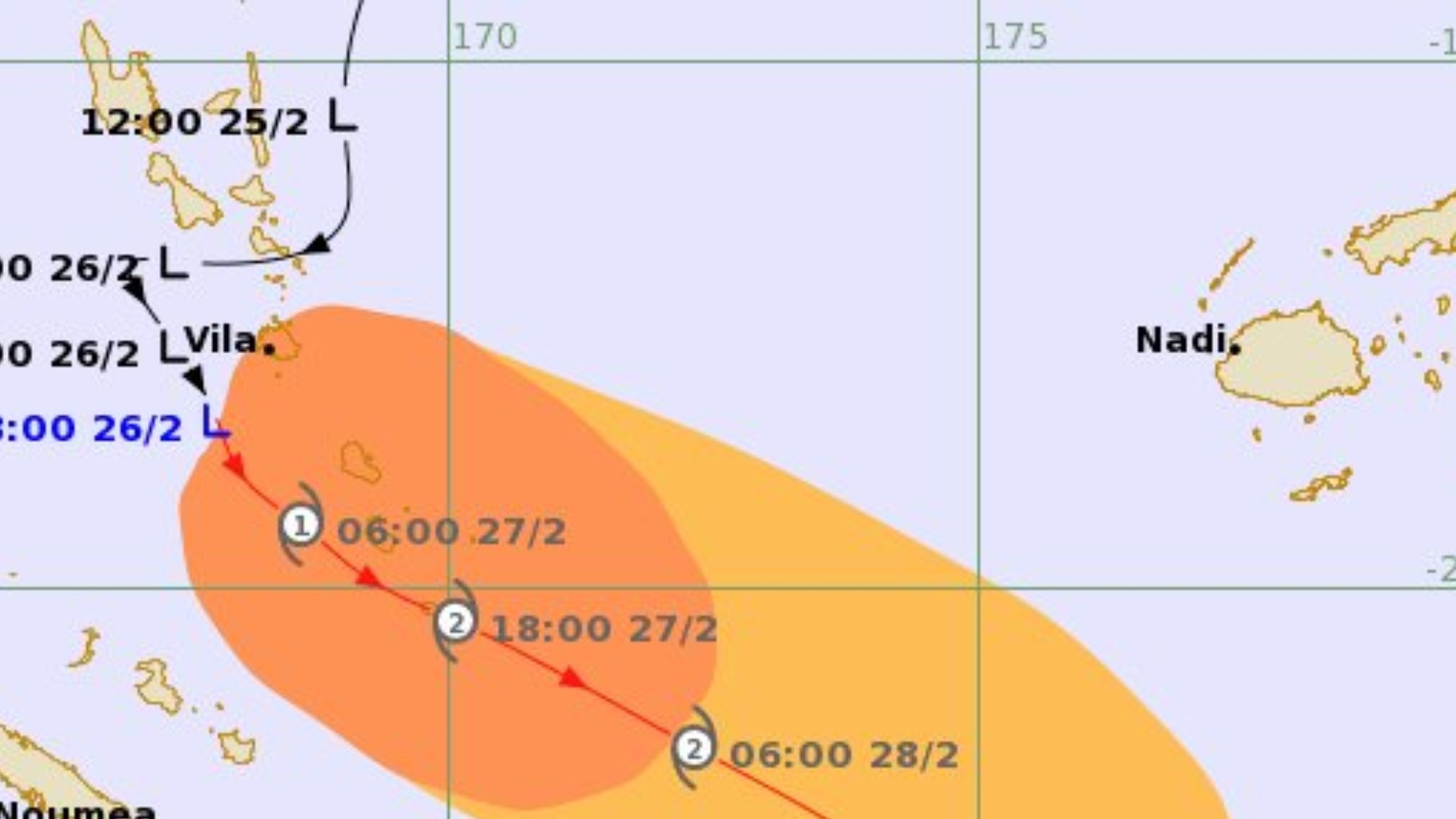
The tropical disturbance which is located about 90 kilometres southwest of Port Vila, Vanuatu, or about 1,020 kilometres west of Nadi, is now a tropical depression, and is expected to develop into a tropical cyclone later today.
The Nadi Weather Office says the system is currently moving south-southeast at around 15 kilometres per hour.
The centre of the system is forecast to remain well to the far west of Fiji and is not expected to move directly over the group.
While the system’s centre will remain distant from Fiji, associated rainbands and strong to gusty north-northwesterly winds are expected to affect parts of the country from tomorrow.
Winds are expected to strengthen in the Western Division and Kadavu from tomorrow.
TD09F continues to draw energy from the warm waters of the Pacific and is anticipated to reach Tropical Cyclone intensity within the next 6 to 12 hours.
A Strong Wind Warning is now in force for the waters of Yasawa and Mamanuca, and southwest Viti Levu which include from Nadi to Sigatoka, a Heavy Rainfall Alert is in place for the Western Division and Kadavu and a Strong Wind Warning for land areas of the Western Division and Kadavu is also in force, with winds expected to strengthen from tomorrow.
Upon intensification, it will be named Tropical Cyclone Urmil, becoming the first named system for the 2025–26 Tropical Cyclone Season.
Be prepared for heavy rain and flooding if you are living in flood prone areas.
Stay with us for the latest forecasts and take necessary precautions.