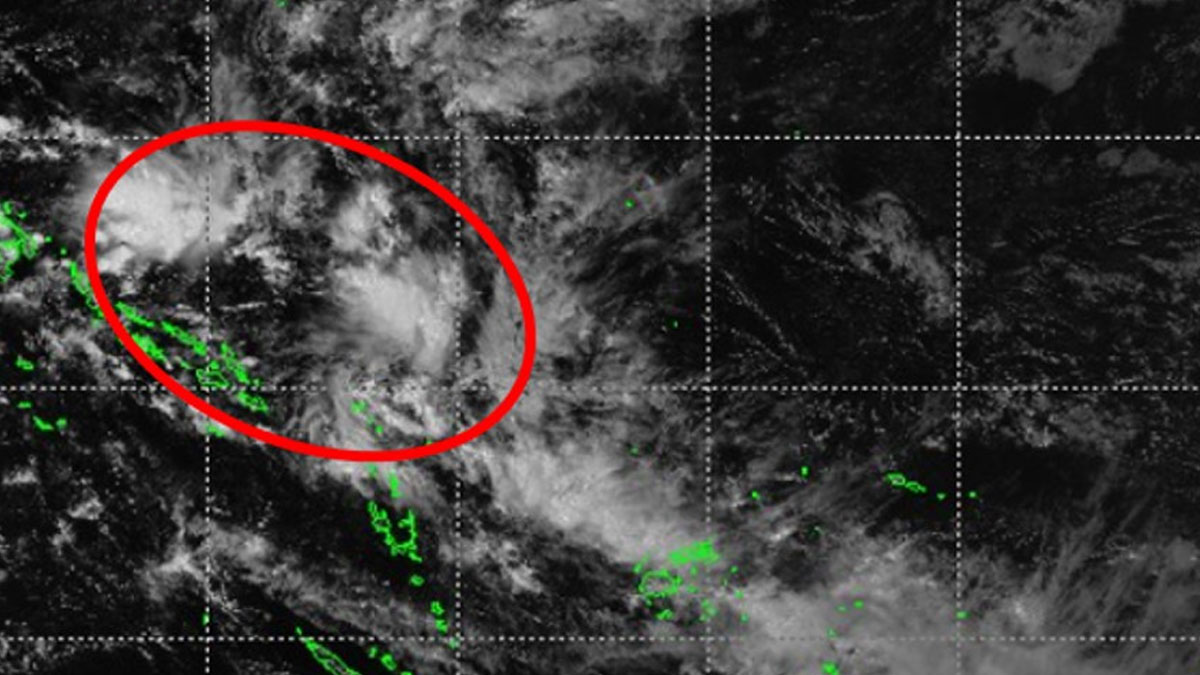
People are advised to take all necessary precautionary measures as we will continue to experience heavy rain from tonight due to the trough of low pressure, and we are expected to experience strong winds, more rain and flooding from Sunday as Tropical Disturbance TD03F, located near Solomon Islands, comes closer to Fiji.
The Fiji Meteorological Service say TD03F is currently in favourable conditions and is expected to move southeast between Vanuatu and Fiji over the next couple of days.
They say there is a moderate to high chance that this system could develop into a Tropical Cyclone after the next 48 hours (from Sunday), with the centre likely to strengthen near Vanuatu.
By Saturday, the centre of the system is expected to be located North of Vanuatu, and by Sunday, East of Vanuatu.
Although the centre of the system is expected to be located outside the Fiji Group, strong winds, heavy rain and flooding is expected.
The system can be upgraded to a Tropical Cyclone by Sunday.
Expect fresh to strong northerly winds to affect parts of the country later Sunday or early Monday, with average winds of up to 55 km/hr and gusts up to 80 km/hr.
The Weather Office says winds may increase further to near-gale or gale strength, depending on the system’s development and track, and rainy conditions will continue across Fiji into next week due to an active trough of low pressure over the group.
Meanwhile, a flash flood warning is now in force for the Serua coastal areas to Suva and Nausori.
A flash flood alert remains in force for the whole of Fiji.
Expect flooding of drainage systems, small streams, low water bridges, Irish crossings, roads and properties in low lying areas.