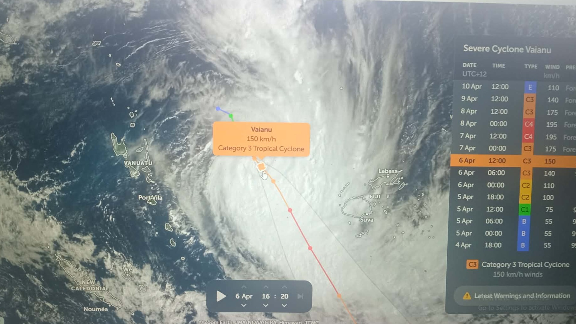
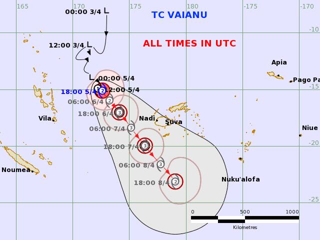
The Fiji Meteorological Service says Tropical Cyclone Vaianu is expected to intensify into a severe Category 3 system by early tomorrow.
The Weather Office says the system may intensify later tonight into tomorrow, and it is expected to be a Category 3 system when it passes southwest of Fiji.
They say TC Vaianu was located about 500 kilometres west-northwest of Yasawa-i-Rara and 520km west northwest of Nadi at midday today and is moving southeast at about 10 kilometres per hour.
They add that the centre is expected to remain in open waters to the southwest of Fiji; however, strong winds are expected across the group from later today into tomorrow.
The Weather Office says their Yasawa-i-Rara station is reporting strong winds of 24 knots, or 27 kilometres per hour, which are expected to gradually increase over most parts of the group from tomorrow.
Northeasterly winds of up to 45 kilometres per hour, with gusts of up to 60 kilometres per hour, are expected, increasing to sustained winds of 60 kilometres per hour with gusts of up to 90 kilometres per hour from tomorrow.
Meanwhile, a Heavy Rain Warning and a Flash Flood Alert remain in force for the whole of Fiji.
A Strong Wind Warning remains in force for the Northern Division, Yasawa and Mamanuca group, the western half of Viti Levu from Sigatoka, along the Coral Coast, through Nadi to Rakiraki, Kadavu, and nearby smaller islands.
A Strong Wind Alert is now in force for the rest of the country.
Possible impacts include flooding of drainage systems, small streams, low water bridges, Irish crossings, roads, and properties in low-lying areas.
Stay with us for updates.