The government is in the process of upgrading the coordinate system of Fiji’s local Map Grid 1986 to enable safer air, land and sea navigation through the use of GPS.
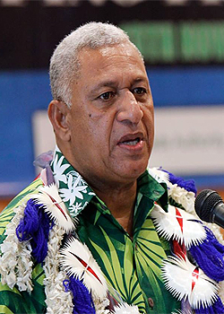
Prime Minister, Voreqe Bainimarama highlighted this while speaking at the opening of the 2nd High Level Geospatial Information Management Conference in Suva.
He says this will also give a better understanding of the adverse effects of rising sea levels and help Fiji develop strategies that can save lives of Fijians threatened by climate change.
Bainimarama says the Fijian Government has remained committed to the wide-spread use of geospatial technologies and to bringing our existing technologies in line with international standards.
He says they will continue to support the industry in the face of new challenges.
The Prime Minister says being a serious player in the GIS industry, there is a need to shift the focus to the integration of GIS capabilities meaning making fundamental data openly available.
Bainimarama adds his government is supporting the mapping of government assets and exploring the use of Unmanned Aerial Vehicles.
He says they have also recently established a Geo-Spatial Unit within the Ministry for Lands and Mineral Resources to advance the quality and accessibility of Government services.